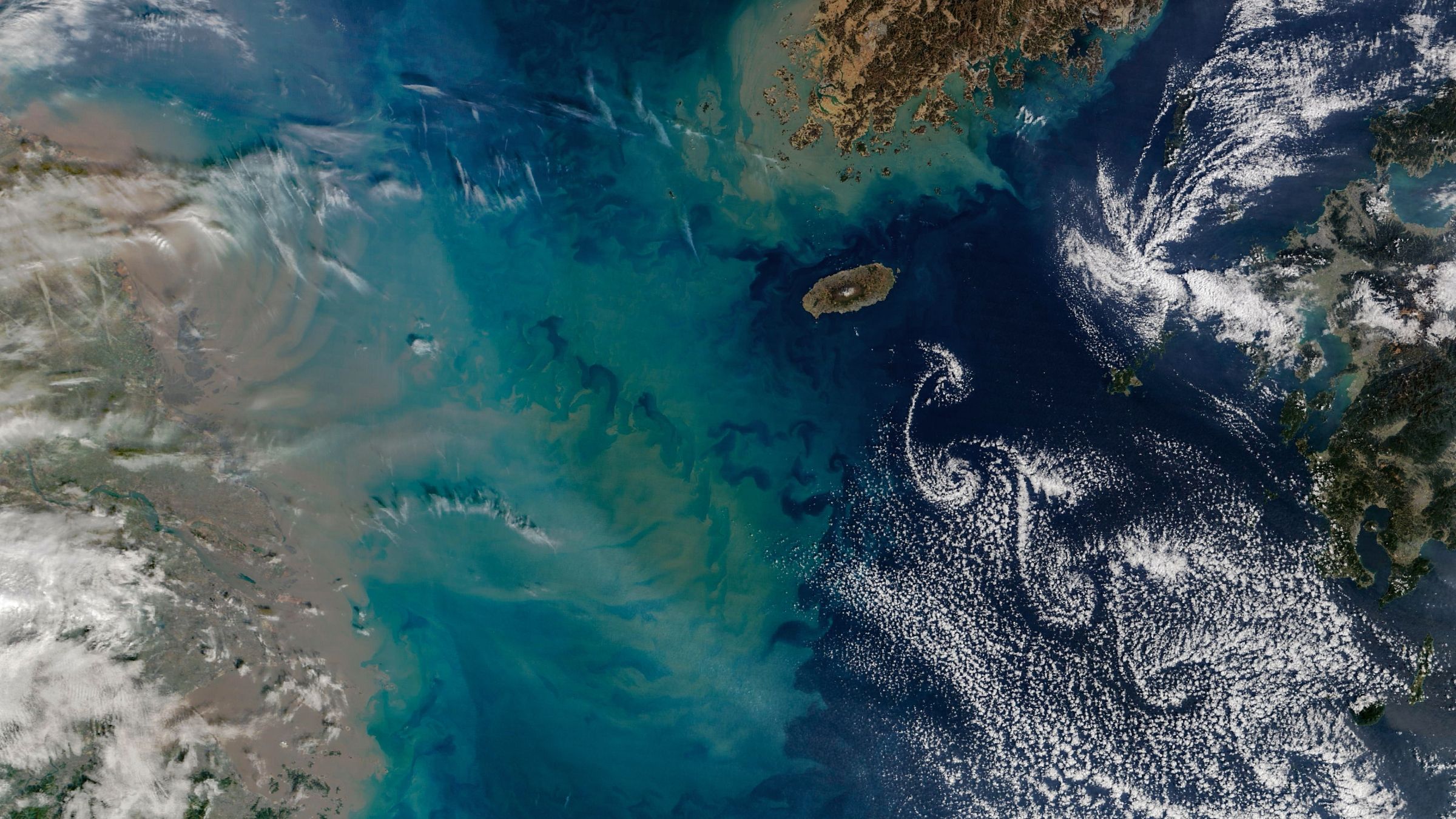
A NASA satellite image captured on February 19, 2026, reveals a striking natural phenomenon near Jeju Island in South Korea’s East China Sea. The photograph shows two distinct features: swirling cloud formations and an expansive sediment plume stretching across the waters between South Korea, China, and Japan.
The distinctive cloud patterns, called Kármán vortex streets, formed as winds circled Hallasan, a 6,400-foot shield volcano on Jeju Island. When wind speeds range between 11 and 34 mph, air currents flowing around the elevated peak create spinning vortices on the downwind side that sculpt nearby clouds into intricate swirling shapes. The three largest spirals in this image extend approximately 230 miles from end to end. Such formations also appear near other island peaks worldwide, including Mexico’s Guadalupe Island and Spain’s Canary Islands.
Accompanying the cloud display is a massive sediment plume originating from China’s coastline. The brownish sediment discharged by the Yangtze River, Earth’s third-longest waterway, regularly appears in satellite imagery year-round. However, this particular image captures an unusually distinct yellow and green sediment plume extending up to 270 miles offshore—likely resulting from increased rainfall, stronger seasonal ocean currents, and winter mixing conditions. The co-occurrence of both atmospheric and oceanic phenomena in a single photograph remains relatively uncommon.
Originally reported by Livescience →
About the Author