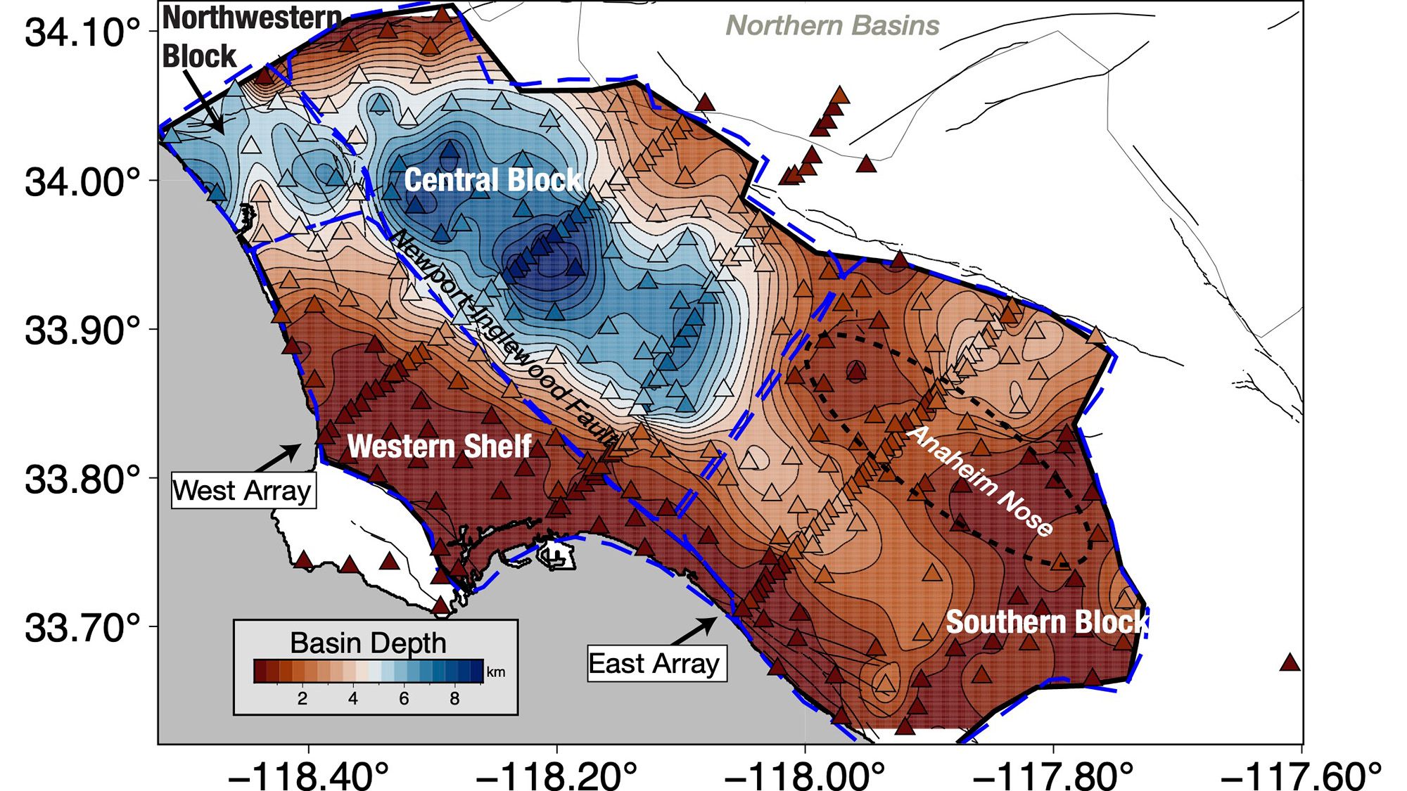
Researchers have created a detailed three-dimensional map of the geological structures beneath Los Angeles, providing new insights into earthquake vulnerability across the region. The model reveals that the downtown area rests on up to 6.2 miles of sediment, which can amplify seismic shaking during earthquakes. While scientists previously understood the basin’s general features, this represents the first comprehensive three-dimensional survey of the area, offering unprecedented precision for risk assessment.
The mapping effort utilized 273 temporary seismic stations positioned around Los Angeles. These instruments detected faint earthquake waves from distant tremors, allowing researchers to construct detailed images of rock layers beneath the surface. The deepest sediment deposits concentrate in the downtown basin, while thinner layers—measuring between 0.6 and 2.5 miles—exist at the basin’s edges before reaching harder crystalline bedrock below.
Understanding basin geometry carries significant implications for earthquake preparedness. Irregular basin boundaries can focus seismic waves in unpredictable ways, potentially causing severe damage in unexpected locations. Engineers and city planners can now use this information to design buildings that avoid resonating with ground motion patterns, potentially reducing structural damage during major seismic events.
The findings provide a foundation for improved simulations and damage predictions should a major earthquake strike the region. However, actual destruction will depend on multiple factors, including which fault ruptures and the earthquake’s magnitude, meaning this map represents one crucial piece of a much larger safety puzzle.
Originally reported by Livescience →
About the Author