
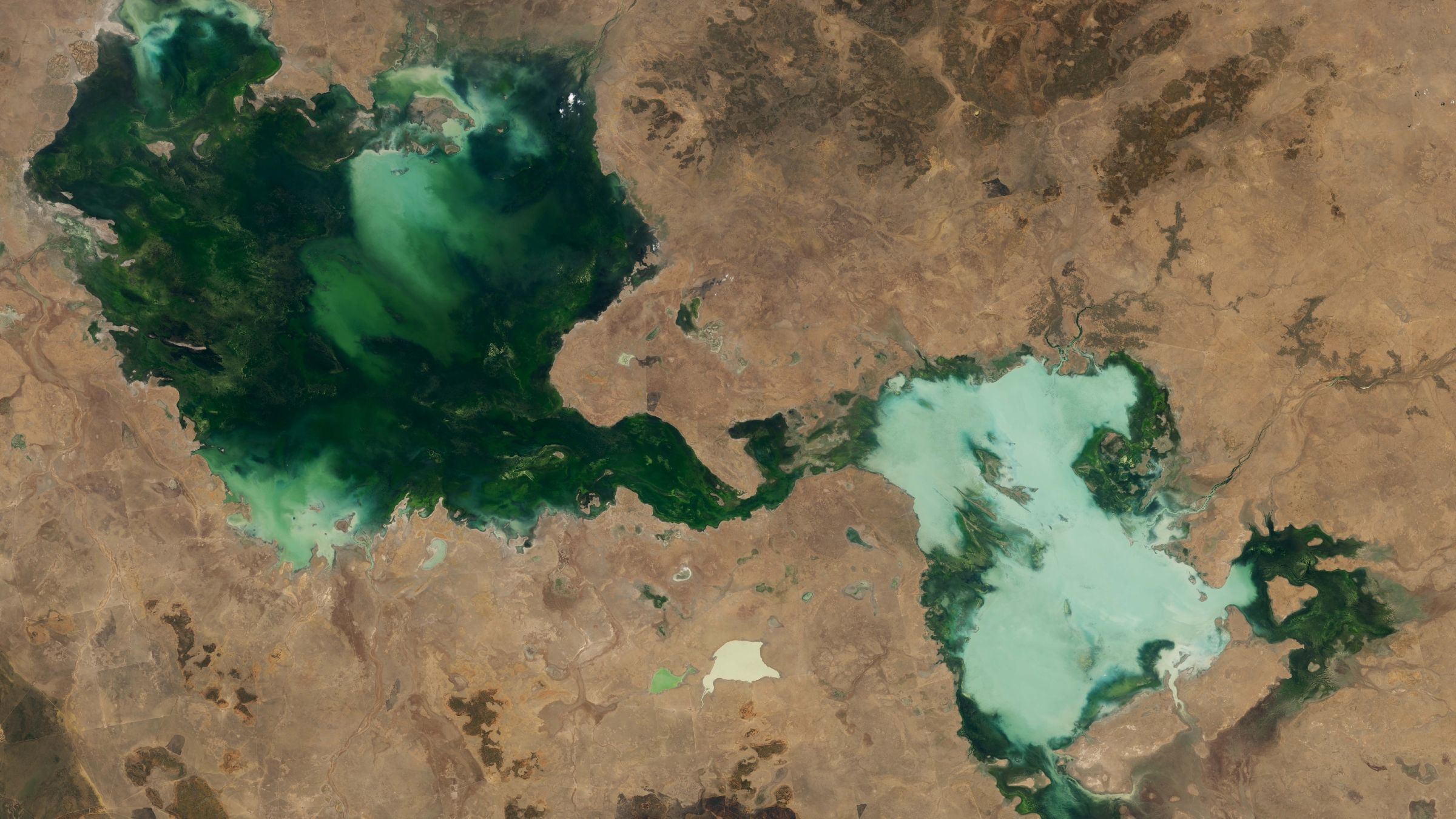
A satellite image captured in late October 2024 reveals a striking transformation in Australia’s Northern Territory, where multiple lakes have merged into a single expansive body of water following two consecutive years of exceptional rainfall. The Barkly Tableland region, situated between Queensland, South Australia, and Western Australia, now displays these interconnected lakes in vivid shades of green and pale blue, photographed by the Landsat 8 satellite.
The merged system comprises Tarrabool Lake, which stretches approximately 55 miles across at its widest point and appears dark green due to dense vegetation and algae, alongside three smaller lakes: Lake Sylvester, Lake Corella, and Lake Deburgh. These smaller bodies display a lighter, chalky appearance caused by elevated suspended sediment levels resulting from the overflow and mixing of waters that disrupted surrounding soil and dust. Normally, these ephemeral lakes dry out completely during extended dry periods, but persistent heavy rains from 2022 through 2024 prevented this natural cycle.
The unprecedented moisture conditions stem from exceptionally wet rainy seasons, with both 2022-2023 and 2023-2024 ranked among the ten wettest since 1990, according to NASA’s Earth Observatory. Tropical Cyclone Megan contributed significantly in March 2024, producing such severe flooding that fish were observed swimming across nearby roads. Climate scientists attribute the region’s approximately 14 percent rainfall increase since 1989 to human-caused climate change.
At full capacity, these lakes support crucial wildlife habitats, serving as winter breeding grounds for straw-necked ibises and Australian pelicans while flooding the adjacent Eva Downs Swamp system, creating Australia’s largest wooded wetland.
Originally reported by Livescience →
About the Author